
Uganda: a country to embrace with open arms (Part 1)
On an overcrowded bus on a stifling September afternoon, I left the hot and restless town of Musanze to embark on a road journey that opened my eyes and heart to the hidden preciousness of an unknown and undervalued land.
I had no idea what to look for in that foreign land beyond a two-day safari trip to Queen Elizabeth and several meetings I had planned across the country in eco-lodges, scattered on green patches on the map.The strong presence of the Sabyinyo volcano through the bus windows – which, later on, was supported by the presence of Gahinga and Muhabura – escorted me silently while the sun was going down, and provided great reassurance along the 25 km bumpy bus ride to an unknown land. I crossed the border between Rwanda and Uganda at Cyanika (Kyanika on Ugandan soil) on foot, dragging my luggage back and forth between two offices until my passport gained a brand-new stamp, next to my three-month visa. Finally, when the night had already arrived, I spotted the warm smile of a familiar face waiting for me on the other side of the barriers.
Over the following two weeks, I would cross the country on land from the south-western border with Rwanda to Lake Victoria’s bank, in the calm Entebbe, passing through the chaotic and overwhelming capital Kampala, tormented by endless traffic and livened up by its wild motor bikers.

Kampala – view from the top of the Minaret of the Central Mosque in the Old City.
On the way, I literally straddled the line of the equator, and visited, crossed or brushed sleeves with six of the ten National Parks (NP) that the Uganda Wildlife Authority (UWA) manages – together with twelve Wildlife Reserves, five Community Wildlife Management Areas, and thirteen Wildlife Sanctuaries.

The road trip gave me the opportunity to really appreciate the landscape of a country the same size as the UK, but which felt much bigger and unexplored. I was impressed by the vast spaces around me, especially the rich and varied views, but also the amount of water I saw flowing through them. However, I haven’t yet been to the north-eastern region, which is the only semi-arid area of the country and therefore has different landscapes.

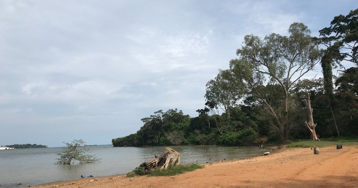
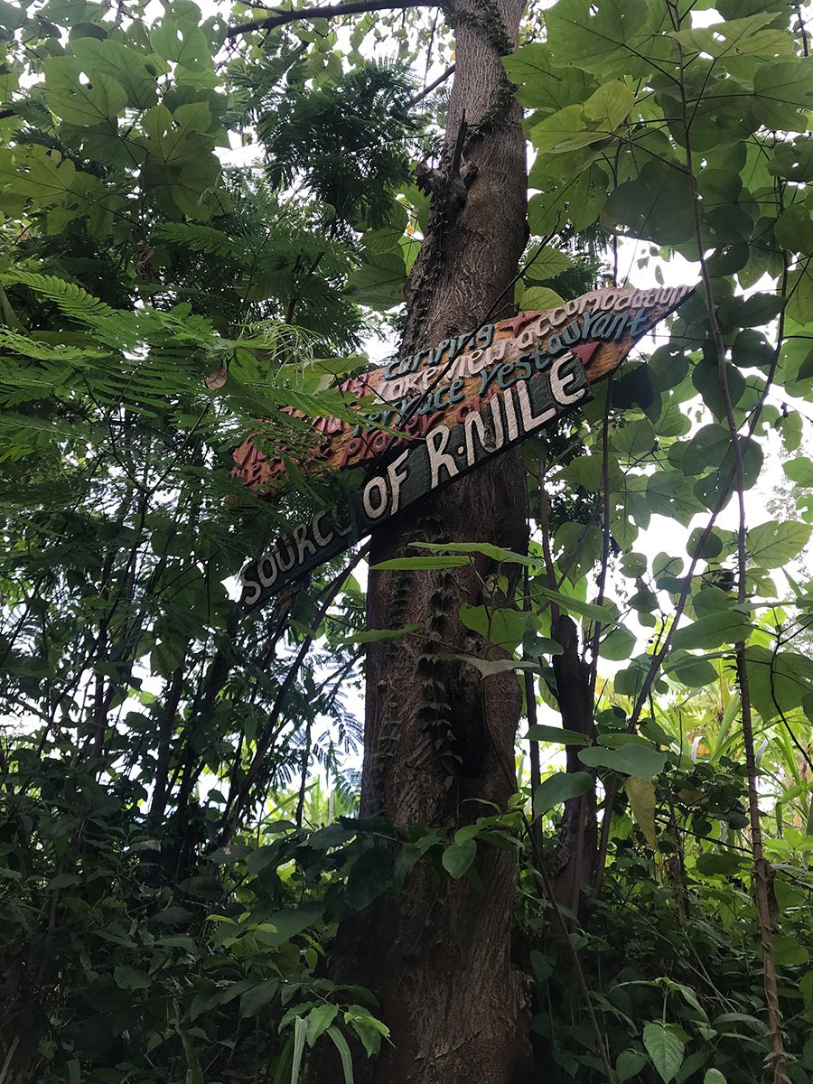
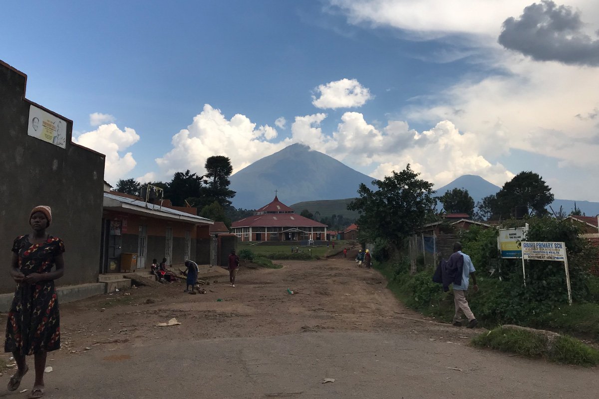
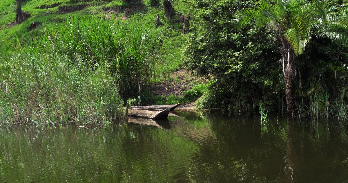
During my trip to most of the rest of the country, I have seen many bodies of water, in the shape of rivers, and lakes – volcanic, small and green, or vast like the sea – waterfalls, streams and a lot of rain. I was also pointed towards the supposed source of the longest river on the planet, although this matter is controversial, because there are three countries vying for who hosts the origin of the Nile. About 8 km from my first stop in Kisoro lies Lake Mutanda, which was created several thousand years ago following a volcanic eruption of the Virunga massif. Surrounded by green hills, the 22 km2 lake is blessed with a clear view of three of the eight Virunga volcanoes that sit in Ugandan territory. Muhabura, with an altitude of 4,127m, is the volcano that dominates Kisoro and the whole region so it is not surprising that it was given this name, which means ‘the guide’, since it used to guide people to the town before GPS became available. This was the first lake I’d seen here, and I had the chance to stay overnight on a tiny, cosy island that had remained uninhabited for at least 600 years. But that is a story for another time.
There is a great view of the lake from the hills, on a small trail going to the organic coffee farm to learn about the local production and have a field-to-cup experience with a skilled guide and the local expert. I took some pictures of the water, but I must admit that I was distracted and entertained by the local children and their goats, that had surrounded me to come and say ‘hi’ and test their English with me.

Hills just outside Kisoro town, walking towards the Organic Coffee Farm with local kids and goats. In the background, Lake Mutanda.
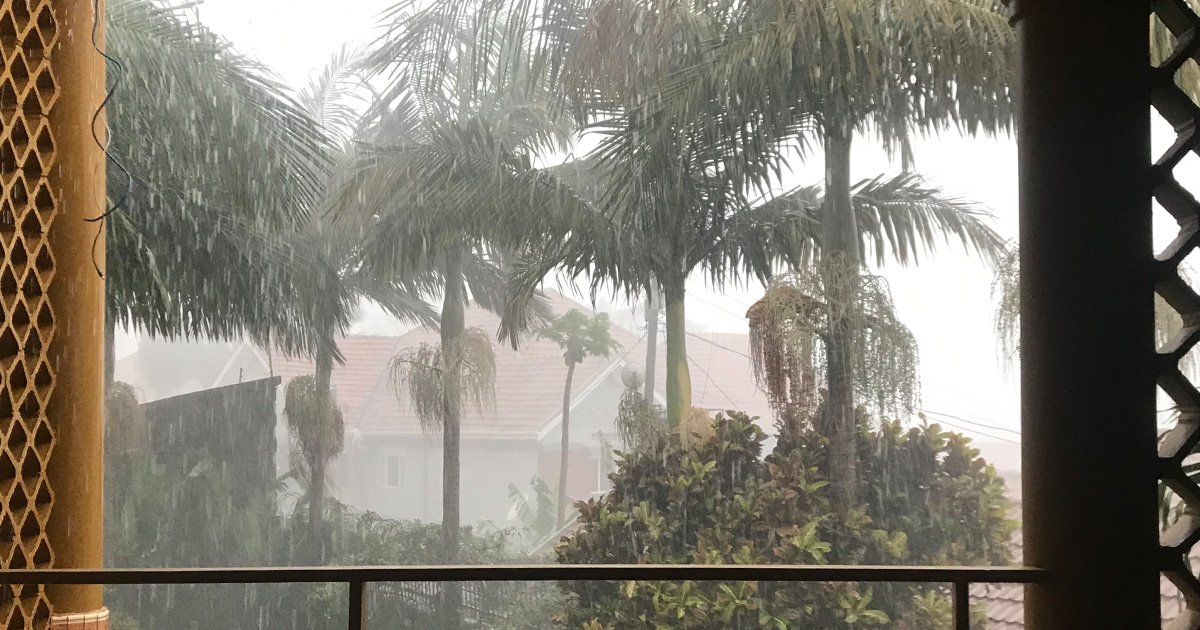
Close to the water…I had a lot of encounters with water, usually joyful and electrifying; even the time when I ended up falling up to my hips in a deep muddy hole when disembarking from a boat, while it was raining cats and dogs. As soon as the fear of having my camera submerged in the mud vanished, I started laughing at the thought of having expected that spot to be rocky, and at being left with foggy glasses. Well, I was happy to have paid that price for having remained on board to take pictures of that – amazing – scene of the rain on the lake Mutanda.


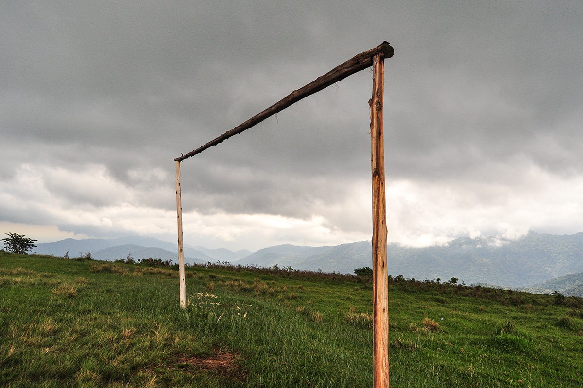
However, the encounter I remember most vividly, without a doubt, was the one I almost had, close to the clouds, when I caught a brief glimpse of the Bwindi NP Forest from a privileged spot. Standing at the edge of an exposed hill facing directly towards the canopy, I saw the changes of scenery, the light forcing through the loaded clouds, and the atmosphere getting heavier, the wind blowing strongly and clouds gathering in preparation for a storm. All framed in that goalpost placed there by the locals for their football games.
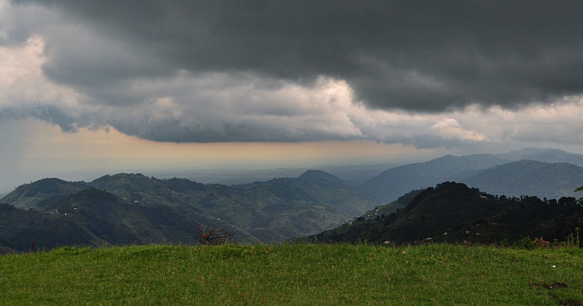
I left the view of the national park behind, driving and skirting along its southern border in the rain and with a strong desire to enter the so-called ‘Impenetrable Forest’ next time. The image of the thick canopy I had seen from the top of the hill, close to the clouds, had generated vivid images in my mind of what could be below the ‘green roof’. Walking through a forest that challenges the light to get in, creating an evocative atmosphere to discover one of most biodiverse forests in Africa which, according to the Bradt guide, includes 160 tree and more than 100 fern species, not to mention 350 bird species, 200 butterfly species, many reptiles and amphibians, and at least 120 species of mammals.
I was reminded that here live 45% of the global population of mountain gorillas, of which there are a total of twenty-three families of habituated groups living in Bwindi NP, while and Mgahinga NP provides the home for only one habituated gorilla group: the Nyakagezi family.

The Twin Crater Lakes: Katinda & Murambi - near Queen Elizabeth NP
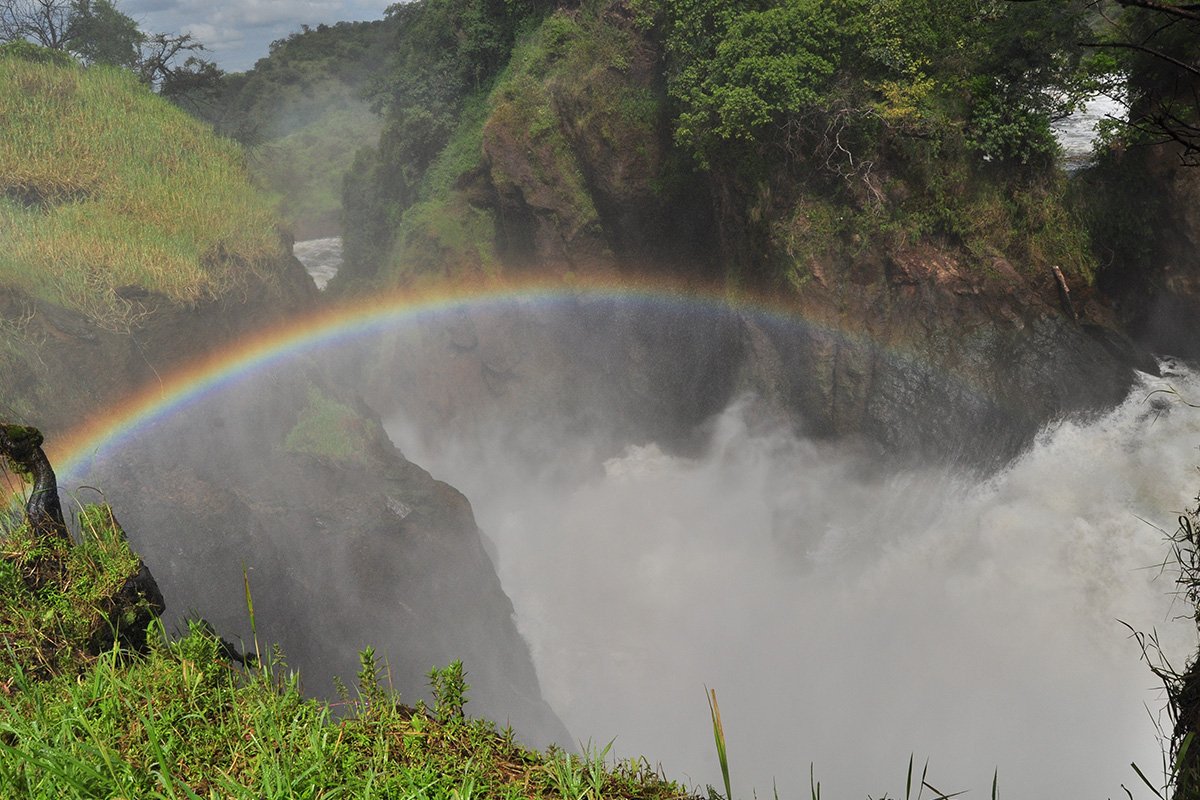
I would see even more water during my trip, after my first stop in Kisoro, including several visits to crater lakes, which was a present from my lovely guide, Abdul, of the experienced local Tour Operator Dav Safari. Another fabulous encounter with water was gifted to me by the lovely General Manager of Nile Safari Lodge, Nathalie Van Pée, who took me to the majestic and mighty Murchison Falls in the north-west of the country.
After a six-hour car ride on a trip spent with my face pressed against the window, awestruck, I arrived at Queen Elizabeth NP, welcomed by a baby elephant concealed in the dark, which my driver spotted before I even realised there was something moving between the bushes on the side of the road. A propitious sign, that marked the beginning of a series of unusual wildlife encounters the next day, which is detailed in ‘Uganda: a country to embrace with open arms (Part 2)’.
(This blog has been written by Elisa Spampinato, a travel writer & Community Storyteller, CEO & Founder at Traveller Storyteller. She travelled to Uganda in September 2022. Photo Credits by Elisa Spampinato)